| Aircraft |
|
377 g
|
|
185×212×64 mm
|
|
6 m/s (Normal mode)
9 m/s (Sport mode)
|
|
6 m/s (Normal mode)
9 m/s (Sport mode)
|
|
8 m/s (Normal mode)
16 m/s (Sport mode)
27 m/s (Manual mode)
*No faster than 19 m/s with the Manual mode in the EU regions.
|
|
5000 m
|
|
Approx. 23 mins
|
|
Approx. 21 mins
|
|
13.0 km
|
|
10.7 m/s (Level 5)
|
|
90°
|
|
-10° to 40° C (14° to 104° F)
|
|
GPS + Galileo + BeiDou
|
|
Vertical:
±0.1 m (with Vision Positioning)
±0.5 m (with GNSS Positioning)Horizontal:
±0.3 m (with Vision Positioning)
±1.5 m (with GNSS Positioning)
|
|
46 GB
|
| Camera |
|
1/1.3-inch image sensor
Effective Pixels: 12 MP
|
|
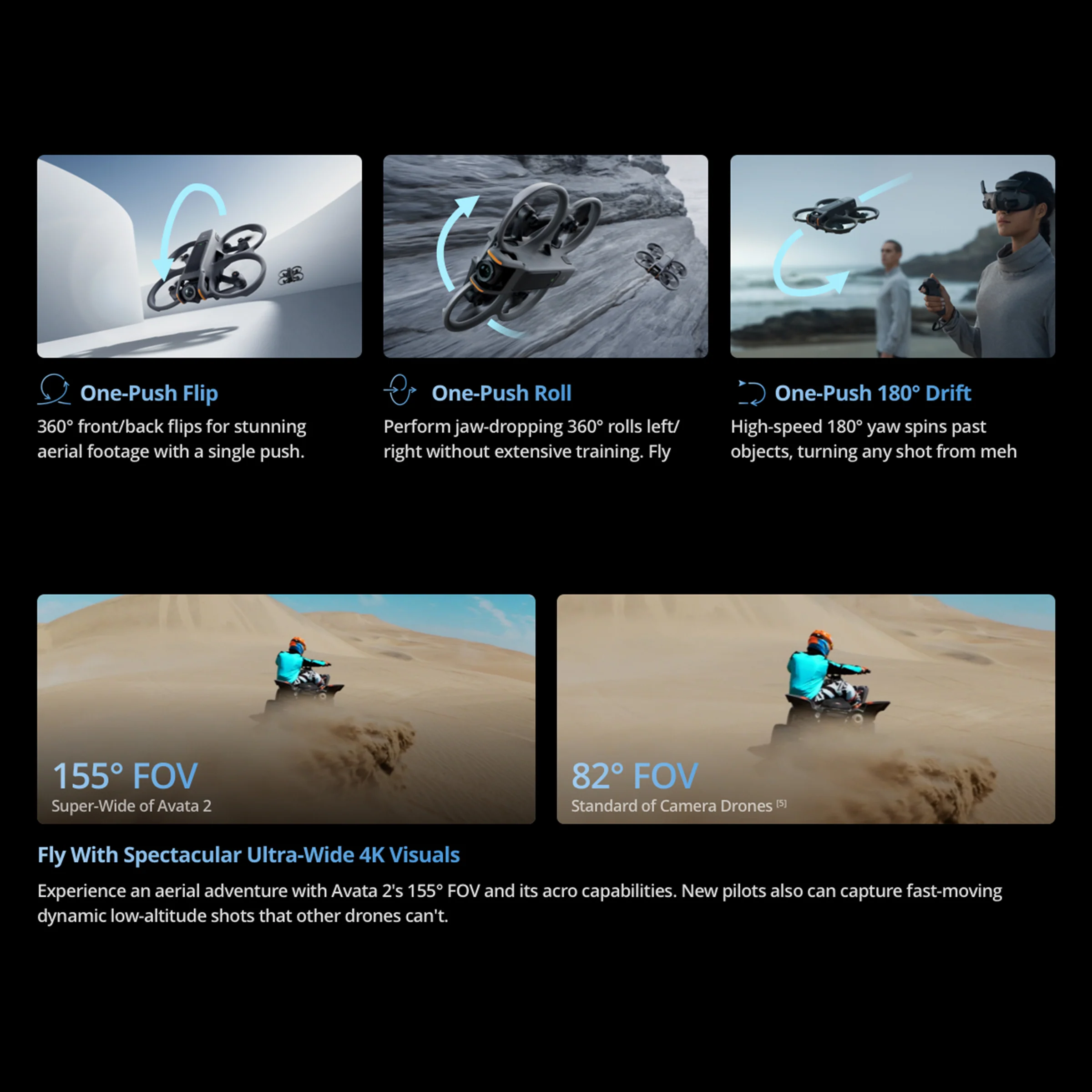
FOV: 155°
Aperture: f/2.8
Focus Mode: FF
Focus Range: 0.6 m to ∞
|
|
100-25600 (Auto)
100-25600 (Manual)
|
|
Video: 1/8000-1/30 s
Photo: 1/8000-1/50 s
|
|
4000×3000
|
|
Single Shot
|
|
JPEG
|
|
4K (4∶3): 3840×2880@30/50/60fps
4K (16∶9): 3840×2160@30/50/60fps
2.7K (4∶3): 2688×2016@30/50/60fps
2.7K (16∶9): 2688×1512@30/50/120fps
1080p (4∶3): 1440×1080@30/50/120fps
1080p (16∶9): 1920×1080@30/50/120fps
|
|
MP4 (H.264/H.265)
|
|
130 Mbps
|
|
exFAT
|
|
Standard
D-Cinelike
|
|
N/A
|
| Sensing |
|
Downward and backward visual positioning
|
|
N/A
|
|
Measurement Range: 0.5-20 m
FOV: Horizontal 78°, Vertical 78°
|
|
N/A
|
|
N/A
|
|
ToF Effective Measurement Height: 10 m
Precise Hovering Range: 0.3-10 m
Measurement Range: 0.3-20 m
FOV: Horizontal 78°, Vertical 78°
|
| Video Transmission |
|
O4
|
|
1080p@30/50/60/100fps
|
|
2.400-2.4835 GHz
5.170-5.250 GHz*
5.725-5.850 GHz*
* 5.170-5.250 GHz and 5.725-5.850 GHz can be used only in
|
|
FCC: < 33 dBm
CE: < 14 dBm
SRRC: < 30 dBm
|
|
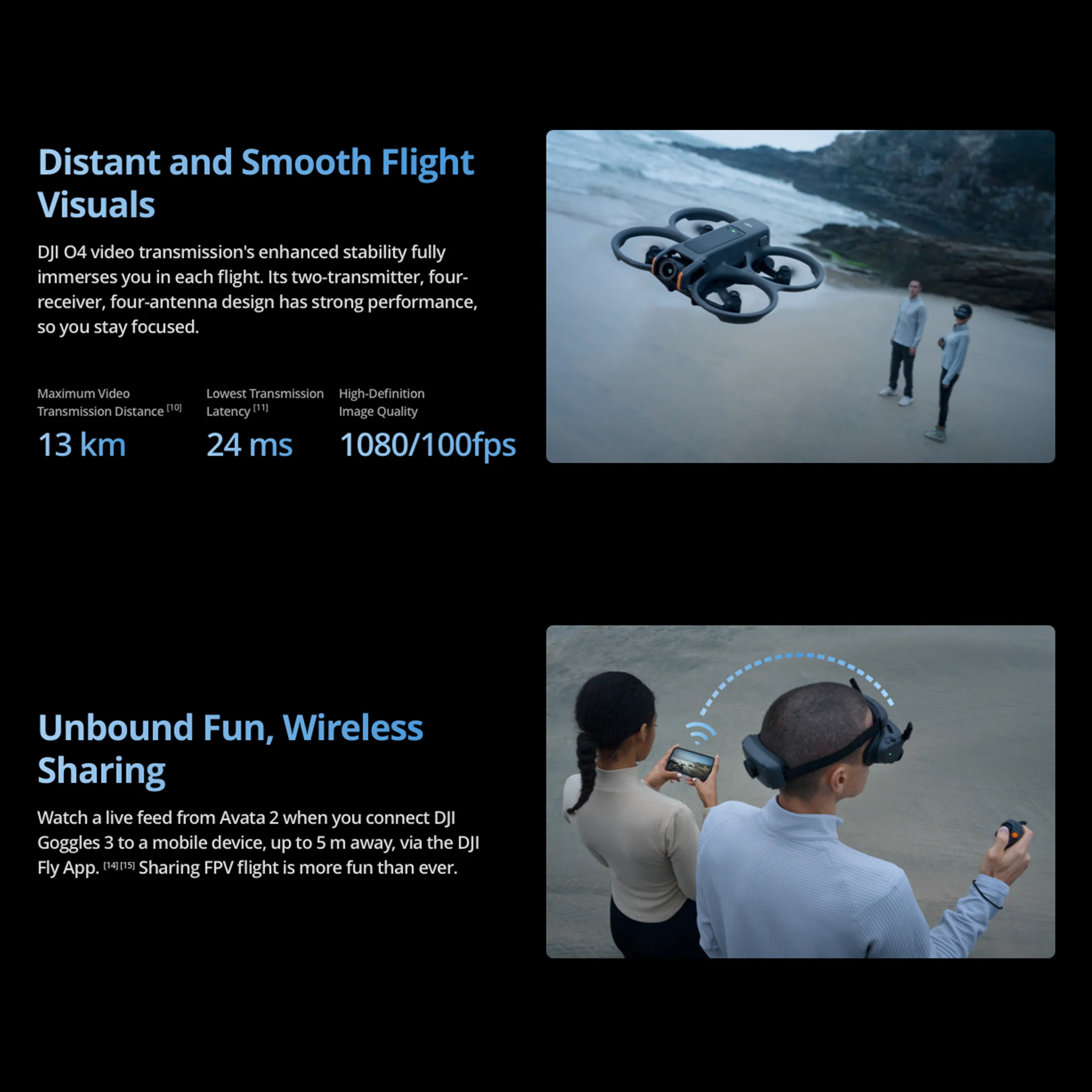
FCC: 13 km (subject to the aircraft’s max flight distance)
CE: 10 km
SRRC: 10 km
MIC: 10 km
Measured in an unobstructed outdoor environment free of interference. The above data shows the farthest communication range for one-way, non-return flights under each standard. Always pay attention to RTH reminders on the goggles screen during your flight.
|
|
Strong Interference: Urban landscape, approx. 1.5-4 km
Medium Interference: Suburban landscape, approx. 4-10 km
Low Interference: Suburb/seaside, approx. 10-13 km
Data tested under FCC standard in unobstructed environments with typical interference. Used for reference purposes only and provides no guarantee for actual transmission distance.”
|
|
Wi-Fi: 30 MB/s*
* Measured in a laboratory environment with little interference in countries/regions that support both 2.4 GHz and 5.8 GHz. Download speeds may vary depending on the actual conditions.
|
|
With DJI Goggles 3:
1080p/100fps Video Transmission Quality: 24 ms
1080p/60fps Video Transmission Quality: 40 ms
|
|
4 antennas, 2T4R
|
| Battery |
|
2150 mAh
|
|
162 g
|
|
14.76 V
|
|
17 V
|
|
Li-ion
|
|
31.7 Wh@0.5C
|
|
5° to 40° C (41° to 104° F)
|
|
With Charging Hub (60W max charging power):
From 0 to 100%: approx. 45 min
From 10 to 90%: approx. 30 min
Directly Charging the Drone (30 W max charging power):
From 0 to 100%: approx. 88 min
From 10 to 90%: approx. 60 min
|
| Remote Controller |
|
Approx. 10 hours
|
|
N/A
|
|
-10° to 40° C (14° to 104° F)
|
|
2.400 GHz:
<26 dBm (FCC)
<20 dBm (CE/SRRC/MIC)
|
 Svi proizvodi


 Akcije
 Mobiteli
 Električna vozila
 Klima uređaji
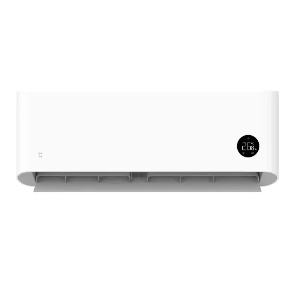
 Xiaomi
 Servis
 Tableti
 Punjači